
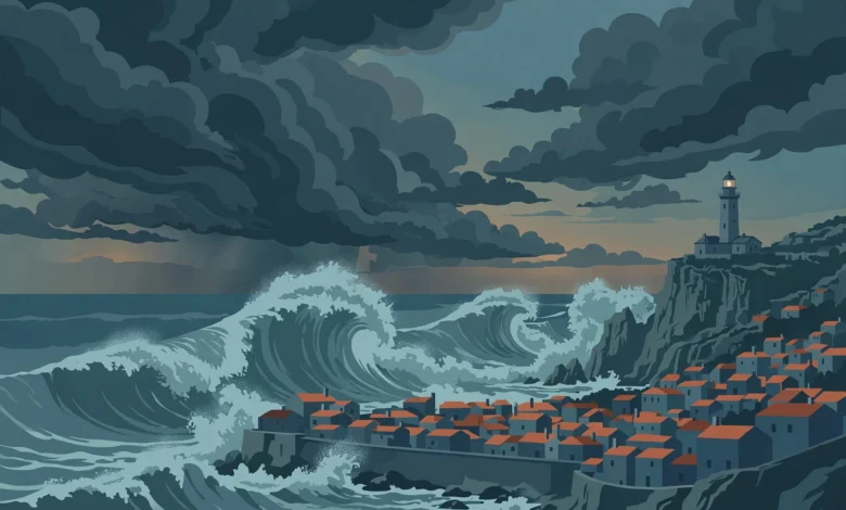
Storm Charles is bearing down on mainland Portugal on Wednesday 11 November 2026, with the country’s weather service issuing its highest red warnings for wind and rain, the government ordering schools and non-essential public services to close, and one of the world’s largest technology conferences cancelling its second day. The storm, the third named system of the 2026/27 south-west Europe season, is expected to make landfall on Wednesday afternoon with gusts of up to 140 km/h in exposed places and waves of up to seven metres along the coast.
Portugal’s Institute for Sea and Atmosphere (IPMA) has placed eight mainland districts under red wind warnings and six under red rain warnings for Wednesday, while Madeira spent Tuesday night under red alerts of its own. Prime Minister Luís Montenegro said the country was in “total readiness” and that there was no reason to panic, as emergency services prepared for flooding, falling trees and power cuts.
| Storm Charles Portugal — Quick Reference Summary | |
|---|---|
| Storm | Storm Charles (depression Charles), third named storm of the 2026/27 south-west Europe season, after Adam and Bruna |
| Date of peak impact | Wednesday 11 November 2026 |
| Areas affected | Madeira, mainland Portugal, western and central Spain |
| Highest gusts forecast | 100–120 km/h on the mainland, up to 140 km/h in exposed coastal and mountain areas |
| Heaviest rain | More than 100 mm in 12 hours in parts of Madeira; 120–150 mm in 12 hours forecast in parts of the mainland |
| Waves | South-westerly waves of 5–7 metres along the Lisbon, Setúbal, Beja and Faro coasts |
| Official alert | Nationwide state of alert (situação de alerta) across mainland Portugal, 00:00–23:59 on Wednesday 11 November |
| Closures | Schools and non-essential public services closed; Web Summit Day 2 cancelled; Lisbon road tunnels, parks and museums shut |
| UK advice | FCDO travel advice for Portugal updated 10 November: greatest risk expected Wednesday 11 November |
| Source authority | IPMA (Portuguese Institute for Sea and Atmosphere), Portuguese Government, ANEPC |
Red warnings from Madeira to the Algarve
Madeira felt Charles first. IPMA raised the island’s south coast and mountain areas to a red warning for heavy, persistent rain from 21:00 on Tuesday until 06:00 on Wednesday, with a red wind warning in the mountains from midnight to 06:00 and gusts of up to 140 km/h. More than 100 mm of rain was forecast in 12 hours in parts of the island’s high ground, with south-westerly waves of up to 4.5 metres on the south coast. Early reports from Portuguese media pointed to flooding in the Machico area of Madeira overnight.
The mainland warnings take over from Wednesday morning. Red wind warnings run from 09:00 to 21:00 in Beja, Faro and Setúbal, and from noon to 21:00 in Lisbon, Évora, Leiria, Portalegre and Santarém. Red rain warnings apply from noon to 18:00 in Lisbon, Setúbal, Santarém, Leiria, Portalegre and Castelo Branco. Orange warnings for rain and rough seas cover the remaining districts, with waves of five to seven metres forecast along the southern and western coasts from Wednesday afternoon.
| Region | Warning level | What is forecast | When it applies |
|---|---|---|---|
| Madeira south coast and mountains | Red — rain | Heavy, persistent rain; more than 100 mm in 12 hours in high ground | Tue 21:00 – Wed 06:00 |
| Madeira mountains | Red — wind | Gusts up to 140 km/h | Wed 00:00 – 06:00 |
| Beja, Faro, Setúbal | Red — wind | Gusts 100–120 km/h, up to 140 km/h in exposed places | Wed 09:00 – 21:00 |
| Lisbon, Évora, Leiria, Portalegre, Santarém | Red — wind | Gusts 100–120 km/h, up to 140 km/h in exposed places | Wed 12:00 – 21:00 |
| Lisbon, Setúbal, Santarém, Leiria, Portalegre, Castelo Branco | Red — rain | Heavy, persistent rain | Wed 12:00 – 18:00 |
| Lisbon, Setúbal, Beja and Faro coasts | Orange — rough seas | South-westerly waves of 5–7 metres | Wed 12:00 – 21:00 |
The storm’s exact landfall remains uncertain. IPMA’s most likely track takes the centre ashore between Sines and Cabo Carvoeiro, near Peniche, during Wednesday afternoon, though the latest model runs shifted the track further south, putting the Alentejo and Algarve coasts more directly in the firing line than Lisbon and areas further north. Forecasters have stressed that warnings can still be upgraded, extended or lifted as the storm develops.
Schools shut, transport halted and Web Summit called off
The Portuguese government declared a state of alert for the whole of mainland Portugal from midnight to 23:59 on Wednesday, under an order published in the official gazette on Tuesday. Educational establishments, including nurseries and pre-schools, and non-essential public services are closed for the day. Outdoor events are suspended, and access to parks, woodland and seafront areas identified as high risk is temporarily restricted.
The National Authority for Emergency and Civil Protection (ANEPC) warned of flooding, landslides, falling trees, slippery roads and power cuts, and urged people to shelter during the peaks of rain and wind. Lisbon’s city authorities closed all road tunnels, parks and museums as a precaution. National coach operator Rede Expressos suspended all services on Wednesday from 10:00 to 23:59, with automatic refunds for affected tickets, while rail operator CP warned of disruption to services across Tuesday and Wednesday.
The most high-profile casualty of the storm is Web Summit, one of the world’s largest technology conferences. Organisers cancelled Day 2 of the event on Wednesday after the Portuguese government formally advised that it should not take place, citing tidal flooding, severe disruption to public transport and the impact of high winds on external structures. More than 70,000 attendees had been expected at the Altice Arena and FIL exhibition centre in Lisbon. The summit plans to continue on Thursday.
A hybrid storm born over warm Atlantic waters
Charles formed as a low-pressure system over the subtropical North Atlantic, near the Caribbean, and deepened as it tracked east towards Iberia. Climatologists quoted in Portuguese media described it as a hybrid between a tropical and a subtropical storm, because it drew energy from very warm ocean waters rather than from the clash of hot and cold air masses that drives most Atlantic depressions.
Its central pressure was measured at 994 hPa as it moved east, with a cloud mass roughly 500 km across sitting south-west of Portugal on Tuesday afternoon. The storm is drawing in a warm, very humid air mass from tropical latitudes, which is why forecasters expect widespread rainfall that could be heavy or very heavy and persistent across the southern and western halves of the Iberian Peninsula.
IPMA has also flagged the ingredients for a rare “sting jet”, a narrow stream of very strong descending winds that can strike the surface with destructive force. The phenomenon played a part in the damage caused by Storm Kristin earlier in 2026, and Portuguese media reports have suggested gusts could exceed 160 km/h around Greater Lisbon if one forms during Charles. That figure remains a worst-case scenario, not a forecast, and the storm’s track and strength are still subject to change.
What British travellers need to know
Portugal is one of the most popular overseas destinations for British holidaymakers, and the Foreign, Commonwealth and Development Office (FCDO) updated its travel advice for the country on Tuesday afternoon. The FCDO travel advice for Portugal warns that heavy rain, strong winds and dangerous coastal conditions are forecast across mainland Portugal, Madeira and Porto Santo, with the greatest risk expected on Wednesday 11 November. It says the weather may cause flooding, landslides, falling trees and travel disruption, and that schools and public services may close at short notice.
Travellers already in Portugal are advised to follow the instructions of the Portuguese authorities, avoid coastal areas and riverbanks, and check Portugal’s weather service, IPMA for the latest warnings for their district. The United States Embassy in Lisbon issued a similar alert, warning that Charles would bring winds of up to 140 km/h, rough seas and a risk of river overflows and flash flooding.
Flight disruption is likely at Lisbon and Funchal airports, and ferry services may also be affected. Travellers due to fly on Wednesday should check with their airline before heading to the airport, and anyone with a coach or rail journey booked in Portugal should expect cancellations. The storm is forecast to push east on Thursday, with Spain’s weather agency AEMET placing parts of western and central Spain on maximum alert for life-threatening rainfall and flash floods, and an evacuation already ordered in Piedralaves in Ávila province because of local dam failure risks.
Bruna first: the storm Charles is following
Charles is not arriving on dry ground. Storm Bruna, the second named storm of the season, has been sitting to the north-west of the Iberian Peninsula and is expected to remain largely stationary until Friday 13 November. Bruna caused flooding in Madeira over the weekend, leaving ten people homeless and one person still missing, with dozens of flights cancelled at Funchal airport. The island was still clearing debris when Charles approached.
Before Charles arrived, Lisbon firefighters had already dealt with 130 weather-related incidents overnight into Tuesday, mostly minor flooding in homes and public spaces, including on the city’s Segunda Circular road. By late Tuesday morning, electricity distributor E-Redes reported around 2,000 customers without power, mainly in the south. Already wet ground increases the risk of flash flooding, overflowing rivers and landslides when Charles adds its own rainfall.
Charles arrives in a season already shaped by extreme weather, including the record-breaking El Niño now under way in the Pacific, and it follows the record-early weakening of the polar vortex that has driven a surge in UK weather searches this week. Conditions in Portugal should ease on Wednesday night into Thursday, although Bruna could bring further rain after Charles passes.
Frequently asked questions
Q: When will Storm Charles hit Portugal?
A: Madeira faced the worst conditions from Tuesday evening into the early hours of Wednesday 11 November. The mainland peak is expected from late Wednesday morning through the afternoon, with red wind warnings running until 21:00.
Q: Which parts of Portugal are under red warnings?
A: Madeira’s south coast and mountains were under red rain and wind warnings overnight. On the mainland, eight districts carry red wind warnings on Wednesday — Beja, Faro, Setúbal, Lisbon, Évora, Leiria, Portalegre and Santarém — and six carry red rain warnings: Lisbon, Setúbal, Santarém, Leiria, Portalegre and Castelo Branco.
Q: Are schools closed in Portugal on Wednesday 11 November?
A: Yes. The government ordered all educational establishments, including nurseries and pre-schools, and non-essential public services to close across mainland Portugal for the whole day, under a nationwide state of alert.
Q: Has Web Summit been cancelled?
A: Day 2 of Web Summit in Lisbon, scheduled for Wednesday 11 November, was cancelled on the formal advice of the Portuguese government. Organisers said the summit plans to continue on Thursday.
Q: Is it safe to travel to Portugal this week?
A: The FCDO advises British travellers to check its travel advice for Portugal before travelling and to follow local instructions. The greatest risk is expected on Wednesday 11 November, with flooding, landslides, falling trees and travel disruption possible. Conditions should ease from Wednesday night, but Bruna may bring further rain until Friday.
Q: How strong will the winds be?
A: IPMA forecasts gusts of 100–120 km/h on the mainland, reaching up to 140 km/h in exposed coastal and mountain areas. Portuguese media have reported that a rare “sting jet” could push gusts above 160 km/h around Greater Lisbon, but that is a worst-case scenario rather than a forecast.